Welcome to Ebrix Land Surveyors, We offer land surveying services including Beacon re-establishment, land subdivision, amalgamation, partition title search, transfer of land and more. Located in Ruiru Town off Thika superhighway, we are strategically located to offer survey services to Kiambu, Gatundu, Githunguri, Limuru, Juja, Thika, Kikuyu, Nairobi, Kitengela, Machakos and all over Kenya
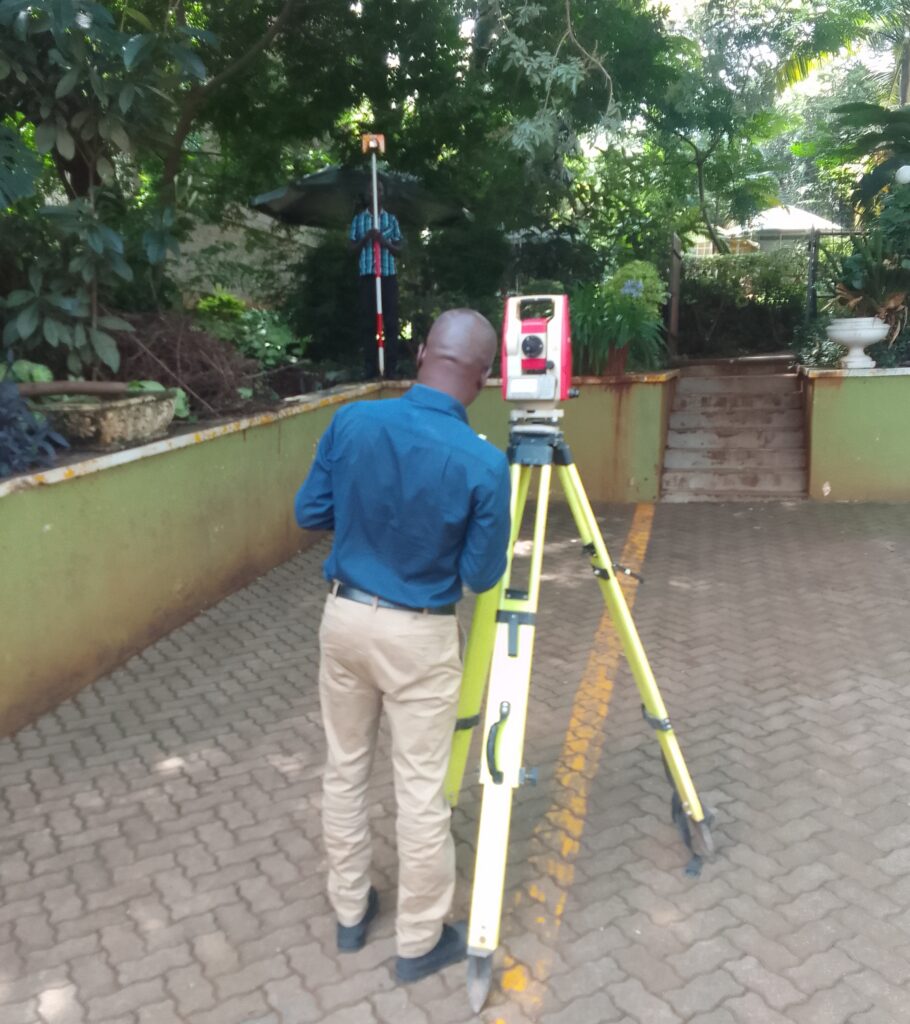
Ebrix was founded with a goal to build a company that offers superior customer service and quality land surveying services, topographical surveys, Construction setting out and as built surveys. Our commitment to accuracy and speed is allowing us to build great relationships with our clients. Our friendly and professional staff are eager to assist you with your surveys needs.
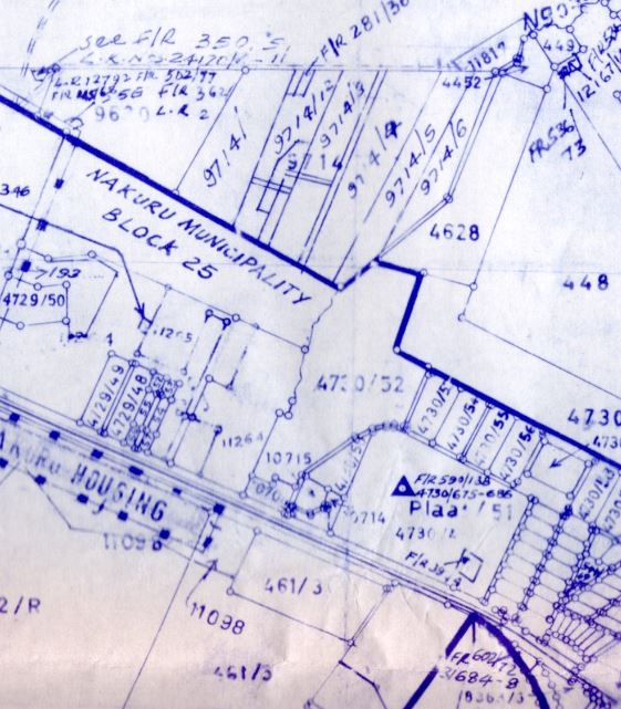
Cadastral/Title Surveys
Our cadastral survey services include subdivisions, amalgamations, partitions and boundary re-establishment surveys. When it comes to cadastral surveys there are two main options, general surveys and fixed surveys.
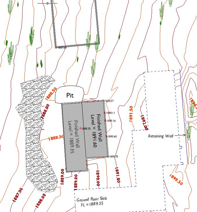
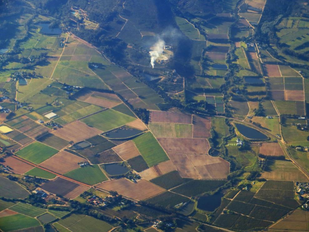
Topographical Surveys
A topographical survey is a type of survey that provides an accurate depiction of the surface features, elevation changes of a property as well as location and condition of existing utilities. This type of survey is essential for property development, as it helps identify potential issues, such as drainage problems.
Land Use Planning
Our planning services adopt an integrated approach with our surveying services. The services include preparing conceptual subdivision design and providing a projected lot yield based on current zoning and design guidelines
Land Search and Information
Each title to land carries its own set of regulations covering limitations, interests, easements and encumbrances. We can access survey plans, historical records of information, property ownership, and tenure data from the relevant Government authorities, and then interpret, analyse, and provide the best advice depending on your end goal.
Sectional Property Surveys
This is a type of survey that involves subdivision of a building into units as per legal requirements in sectional properties Act No. 21 of 2020. A sectional plan is developed and registered and later used in registration and issuance of Certificate of titles/Certificate of Leases of the the resultant units.
LiDAR and 3D Scanning
We capture data from a plethora of sources including drone imagery, LiDAR and 3D Scanning for reality capture.
This will help asset owners and managers to better understand the built environment in improving the lifetime value of assets and in making informed decisions with our intrlligent data analysis solutions.
Talk to us
Have any questions? We are always open to talk to discuss how we can be of help